Street names give us a good indication of what life was like when the roads were first developed. What do the street names in Hainault suggest life was like in the medieval period?
When you stop and look, some street names are pretty strange. It almost looks as if somebody just pulled something out of thin air to give the road any old name. But if you dig a little deeper, you can find out the rich history of a street and an area as a whole.
London has some particularly interesting names. Some examples are:
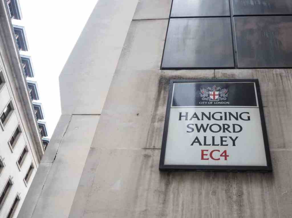
Hanging Sword Alley
In the Tudor period, people on this street didn’t have door numbers, so they hung their swords outside their front door.
This is probably explained by the fact that there were lots of fencing schools in the area, so lots of people owned swords.
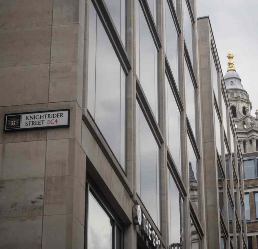
Knightrider Street
One of the coolest street names I’ve heard about, Knightrider Street was given its name in 1322 as knights riding to jousting competitions at the Tower of London would ride down this street together on their way to the competition.
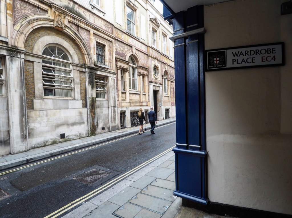
Wardrobe Place
King Edward III bought a whole house on this street in 1359 to act as his walk-in-wardrobe! It continued to be a royal wardrobe until the Great Fire of London destroyed the property in 1666.
What about the street names in Hainault?
The street names in central London mostly reveal the links the streets had to royalty or other notable figures in the Medieval period. Things look very different when we look at Hainault; we start to see a very different way of life outside of England’s capital city.
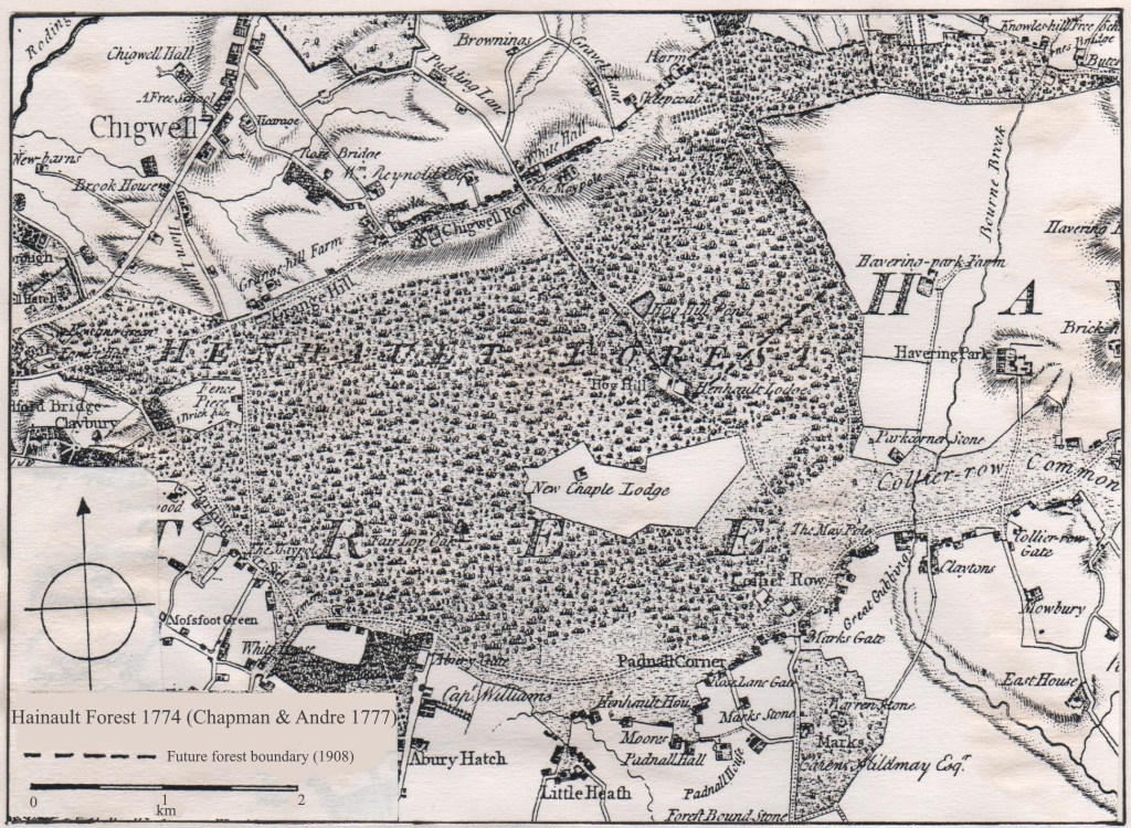
Hainault was not always part of ‘Greater London’. In fact, Hainault did not become built up until the late 1940s after the Second World War was over. After Nazi planes bombed most of the East end of London in the Blitz, people were moved to areas like Redbridge in new houses built by the government.
The town’s streets had been there for hundreds of years. Before building developed in Hainault, the town was dominated by its links to the forest.
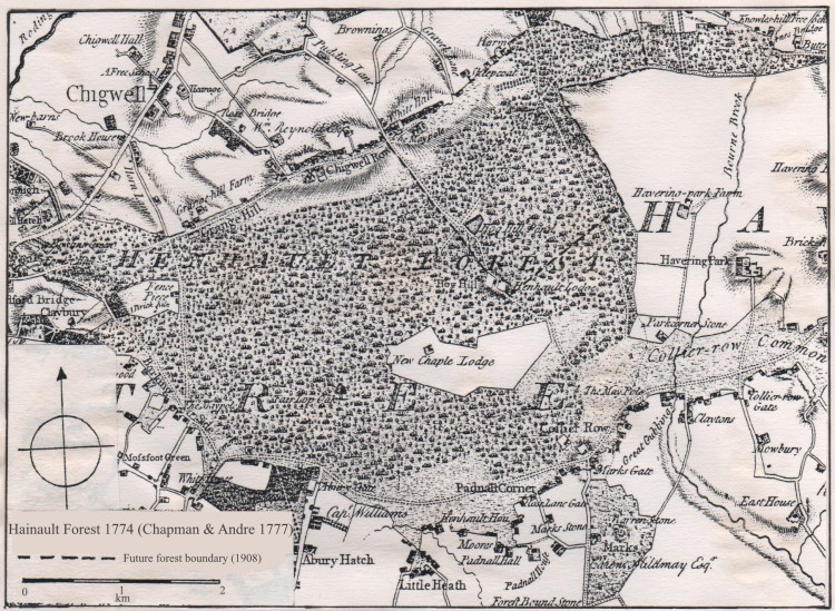

Can you work out what the street names reveal about medieval life in Hainault?
You can download the worksheet for the tasks in this section below.
TASK ONE:
Look at the street names below and pick 6 of these street names to look in to.
For each one can you find out what the word in the street name means?
Can you also explain what that suggests about life in medieval Hainault?
Use the website links below to help you with your research.
What about any roads that are not listed?
| Harbourer Road | Huntsman Road | Regarder Road |
| Agister Road | Arrowsmith Road | Fletcher Road |
| Crossbow Road | Staggart Grove | Brocket Way |
| Fawn Close | Boar Close | Covert Road |
| Peregrine Road | Holt Way | Kingswood |
| Burrow Road | Pollard Way | Coppice Path |
| Verderers Road | Falconer Road | Latchford Place |
| The Lowe | ||
WEBSITE LINKS
Use these links to help you with your research:
History of Hainault Forest
Information on Hainault Street names
Modern map of Hainault (Google Maps)
TASK TWO: Create a street map of medieval Hainault.
Using the research that you have just gathered on the street signs, can you draw your own street map of medieval Hainault?
Your map should outline all the roads that you have researched, detailing their names. There should also be a sketch next to each road that shows why they have been given their name.
What other details could you put on your map to show what Hainault was like? TIP: Think about the forest and the types of people that would be living in the area.
